

OVERVIEW
This section shows the options for Rice Levee Design.DISPLAYED BY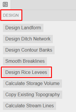
APPEARANCE
OPTIONS
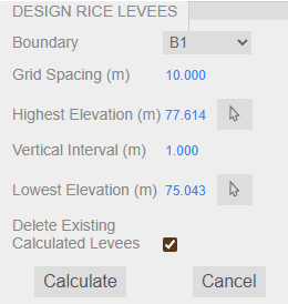
Boundary - select the boundary to calculate on.
Grid Spacing (ft or m) - define the calculation grid spacing.
Highest Elevation (ft or m) - define the highest elevation or use the Pick tool to click on the map the preferred highest elevation.
Vertical Interval (ft or m) - define the rice levee vertical spacing.
Lowest Elevation (ft or m) - define the lowest elevation or use the Pick tool to click on the map the preferred lowest elevation.
Delete Existing Calculated Levees - toggle ON/OFF to delete the calculated levees (if any).
Calculate - hit to proceed with calculation.
Cancel - hit to go back to previous options.
EXAMPLE
The video below demonstrates how to use the Rice Levee Design feature.